Common description
The island of Mont Saint Michel is located in Normandy, the Department of the English Channel.
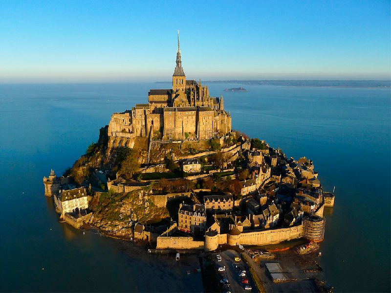
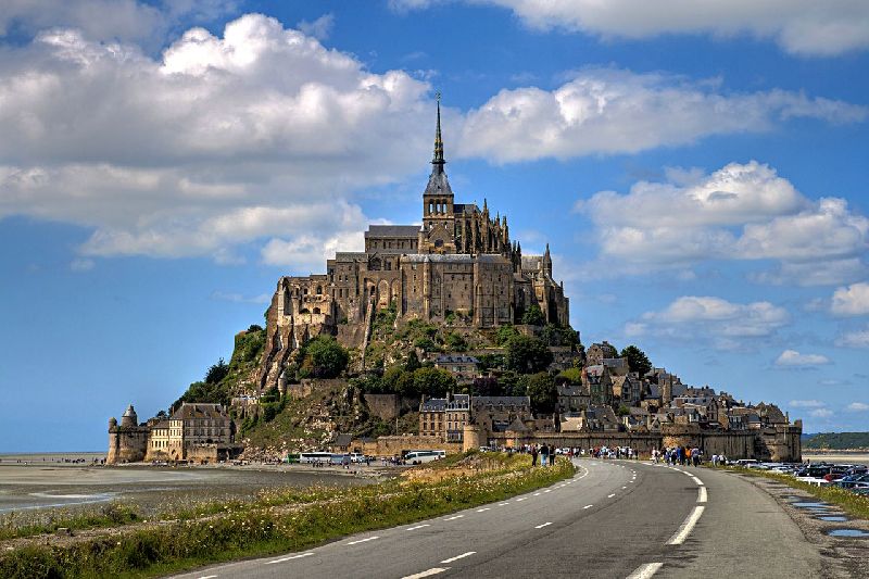
The complex is located on a cliff island, which rises above the average sea level by 78.8 m and stands out sharply against the background of the surrounding space of the bay and flat coast. The island is a conical-shaped granite formation, the perimeter of which is 1 km, formed from weathering-resistant igneous rocks - leucogranites.
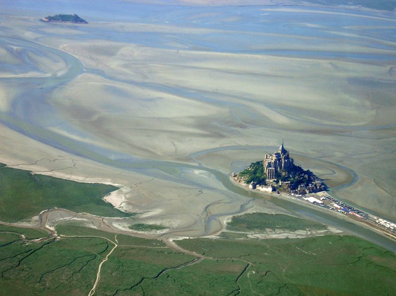
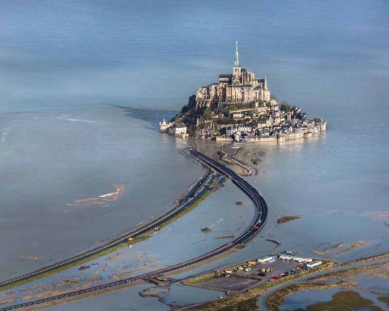
Twice on a lunar day (after 24 hours 50 minutes), tides are observed in the bay, the strongest on the coast of Europe and the second in amplitude (after the Bay of Fundy) all over the globe. During the period of syzygic tides (on the days of the autumn-spring equinox, on the second or third day after the new or full moon), the water lasts 8 hours in winter and 9 hours in summer. Water can go 18 km from Saint-Michel, and extend up to 20 km inland. An extensive comparison of the tide speed at Mont Saint-Michel with the speed of a horse galloping exaggerates the tide speed. The highest possible tidal speed in the Mont Saint-Michel area is 6.12 kilometers per hour. The highest tide height in Europe (up to 14 meters), high tidal wave speed and quicksand bottom sands, together with the steepness of the cliff for centuries, created favorable conditions for solitude and its protection from enemy attacks. At first, the mountain was on land, surrounded by forests, and was the habitat of the Celtic tribes, on which the Druids performed their rites. Then, as a result of soil erosion caused by the activity of the sea and the three rivers flowing into it, the sea came on land. One of the rivers, the Cuenon, which flows into the sea at the dam itself, is now the administrative border between Normandy and Brittany.
The complex is located on a cliff island, which rises above the average sea level by 78.8 m and stands out sharply against the background of the surrounding space of the bay and flat coast. The island is a conical-shaped granite formation, the perimeter of which is 1 km, formed from weathering-resistant igneous rocks - leucogranites.
Twice on a lunar day (after 24 hours 50 minutes), tides are observed in the bay, the strongest on the coast of Europe and the second in amplitude (after the Bay of Fundy) all over the globe. During the period of syzygic tides (on the days of the autumn-spring equinox, on the second or third day after the new or full moon), the water lasts 8 hours in winter and 9 hours in summer. Water can go 18 km from Saint-Michel, and extend up to 20 km inland. An extensive comparison of the tide speed at Mont Saint-Michel with the speed of a horse galloping exaggerates the tide speed. The highest possible tidal speed in the Mont Saint-Michel area is 6.12 kilometers per hour. The highest tide height in Europe (up to 14 meters), high tidal wave speed and quicksand bottom sands, together with the steepness of the cliff for centuries, created favorable conditions for solitude and its protection from enemy attacks. At first, the mountain was on land, surrounded by forests, and was the habitat of the Celtic tribes, on which the Druids performed their rites. Then, as a result of soil erosion caused by the activity of the sea and the three rivers flowing into it, the sea came on land. One of the rivers, the Cuenon, which flows into the sea at the dam itself, is now the administrative border between Normandy and Brittany.
Mont Saint-Michel on map
+ 13°C